Cycling across the United States
In the summer of 2002, my brother and I rode our bicycles from New Haven, Connecticut to Seattle, Washington. The trip was 4,000 miles long and brought us across 10 states and one Canadian province over the course of 64 days. In a world before smartphones and tracking devices, I kept meticulous route notes and logged everything from what I ate for breakfast each morning to how many flat tires I got. I even kept track of how many roadkill I saw.
In 2011, I unearthed all my route maps (which I had saved in a plastic bag), combed through my trip journal, and made some formal visualizations of the trip. These visualizations show my route, point to key events, and include elevation profiles for each state. I've also included some pages from my original journal.
Route Overview

Details


Elevation by State

Sketchbook & Journal
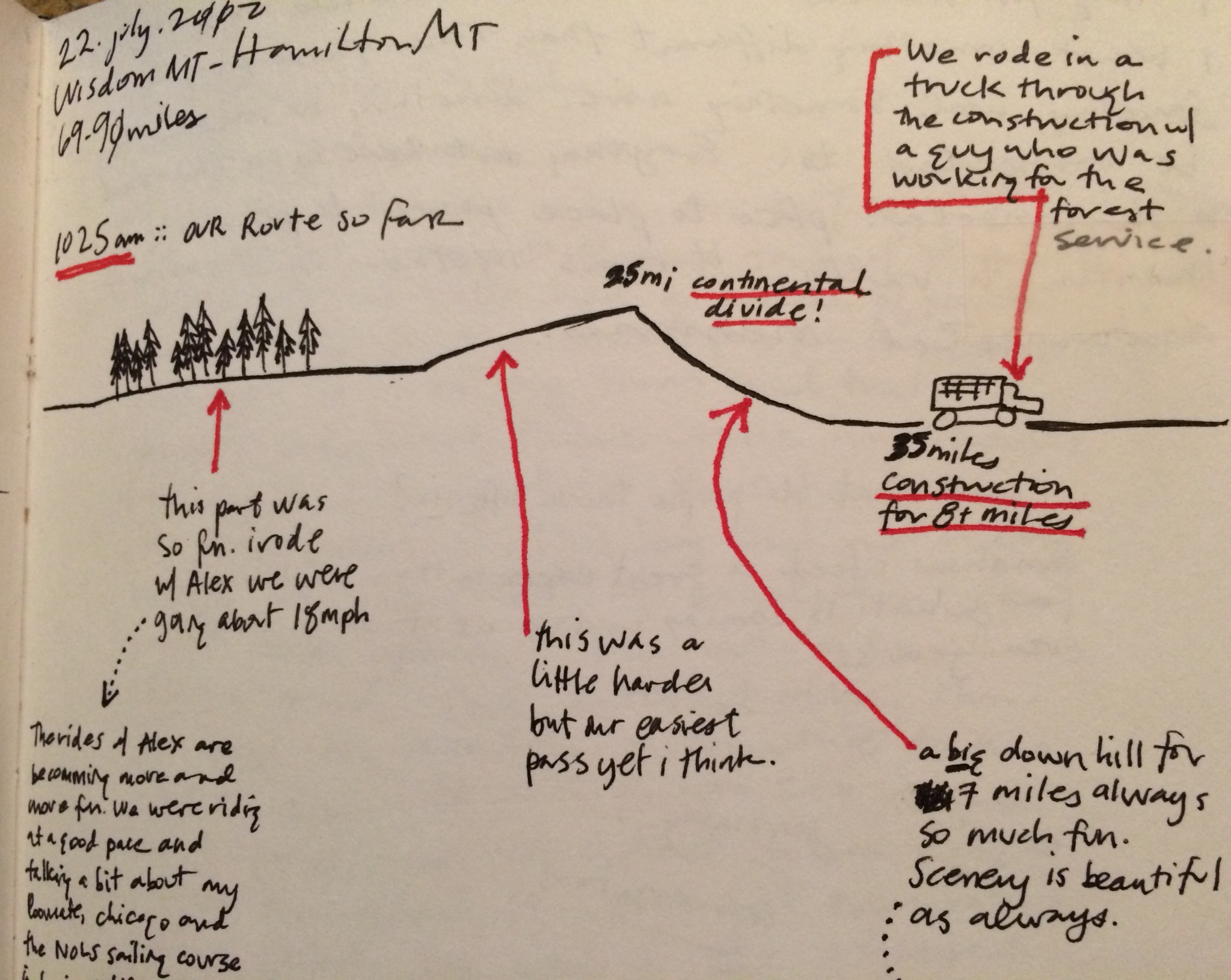
Route diagram as we crossed the Continental Divide

A diagram of one of the churches we stayed at along the way
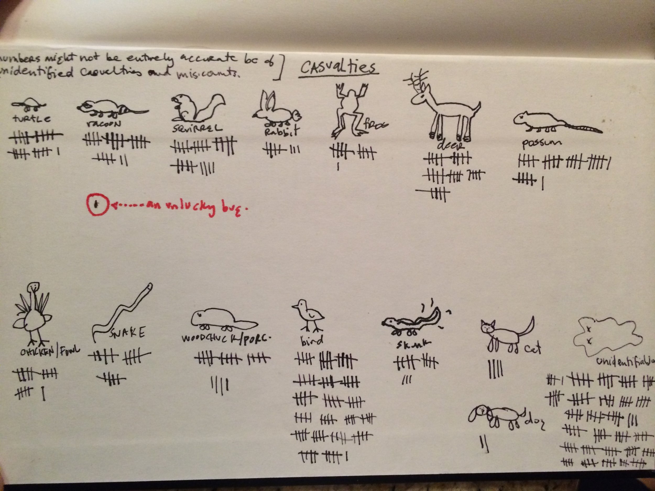
I kept a tally of how much roadkill I saw

Our campsite in Teton National Park